Historical Accounts and Maps of the Goleta Slough
1769 Account of the Goleta Area (including the Slough) by Costanso
(Engineer in the Portola Expedition)
1769 Account of the Goleta Area (including the Slough) by Crespi
(Priest in the Portola Expedition)
1769 Account of the Slough by Fages
(Soldier in the Portola Expedition)
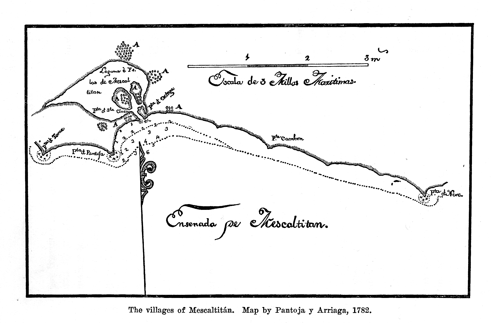
1782 Map by Pantoja y Arriaga
from `Anza's California Expeditions,' Vol. III, H.E.Bolton, Univ. of Calif. Press, 1930
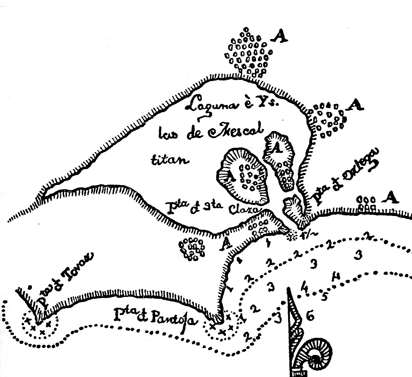
1782 Map by Pantoja y Arriaga, blowup of Goleta Slough
1782 Map by Pantoja y Arriaga, overlayed on a modern map
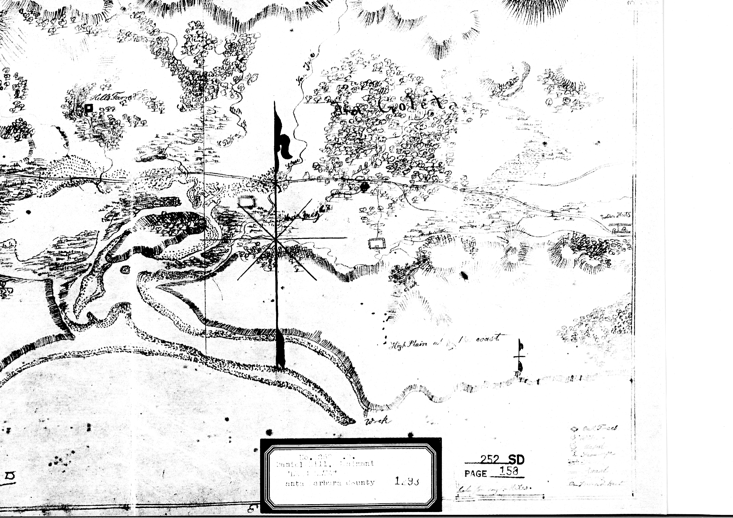
1840's La Goleta Rancho Diseno
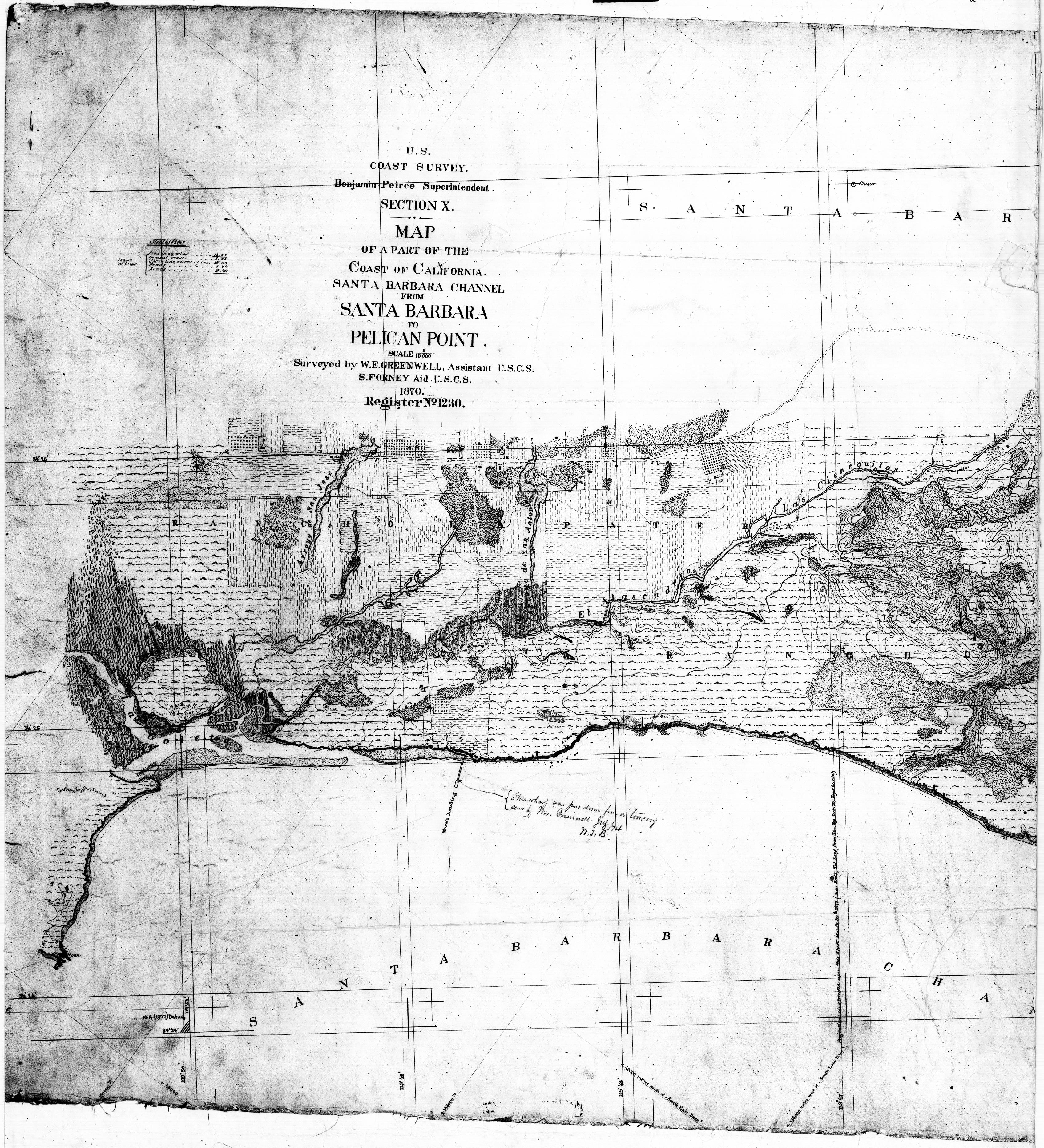
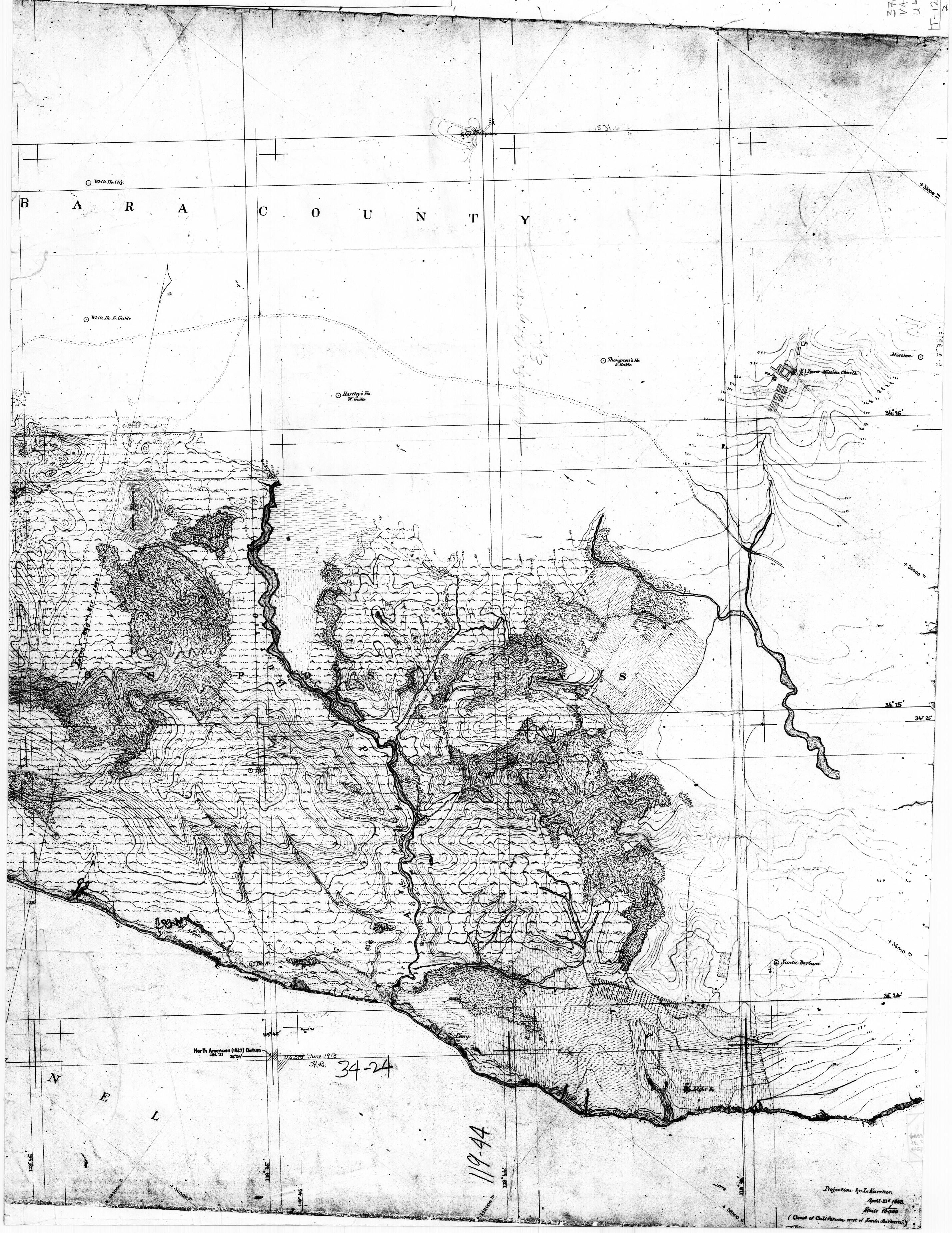
1870 Coastal Survey Chart (T-1230), including the eastern slough
(
Eastern Portion
)
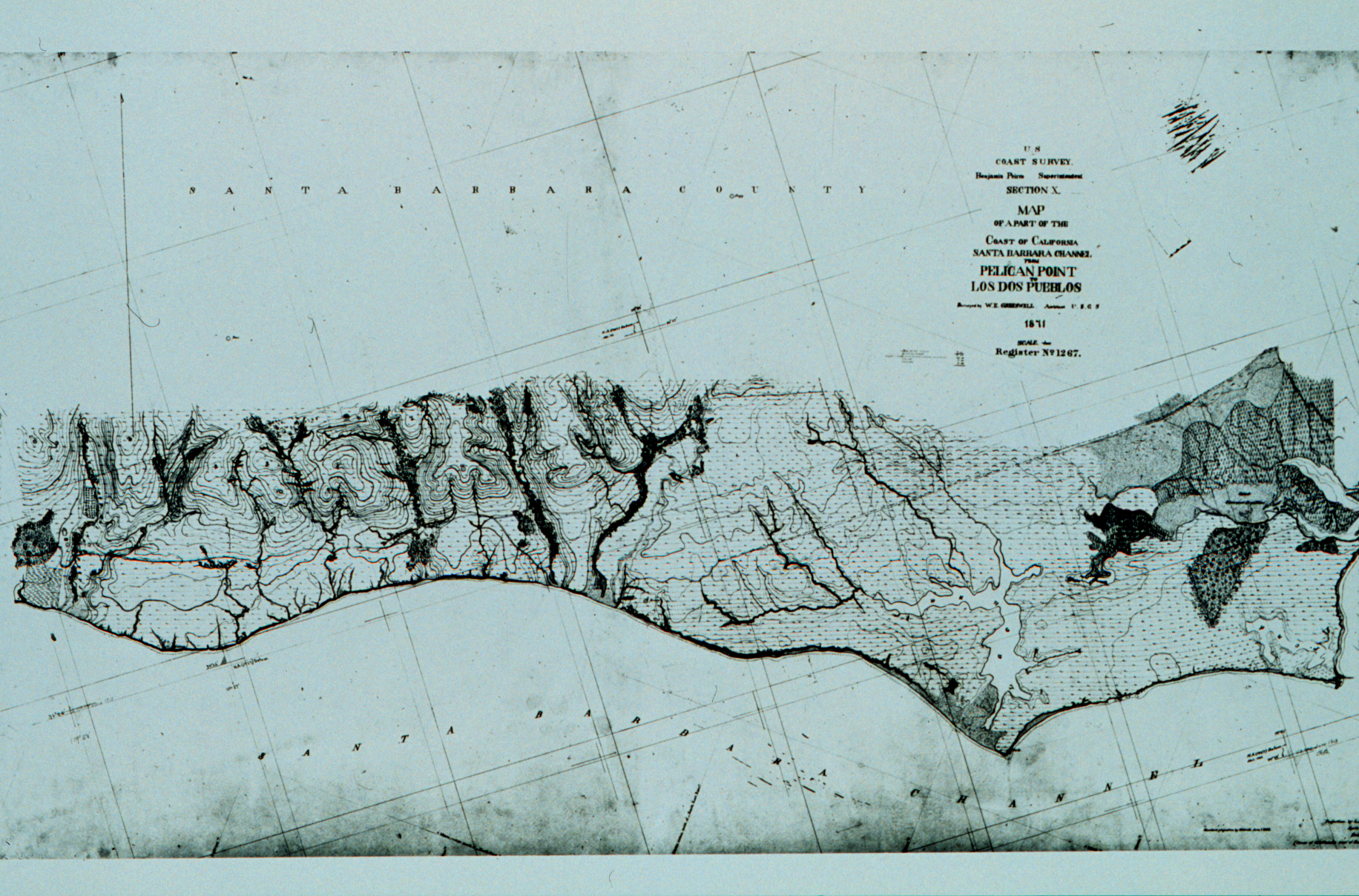
1871 Coastal Survey Chart (T-1267), including the western slough
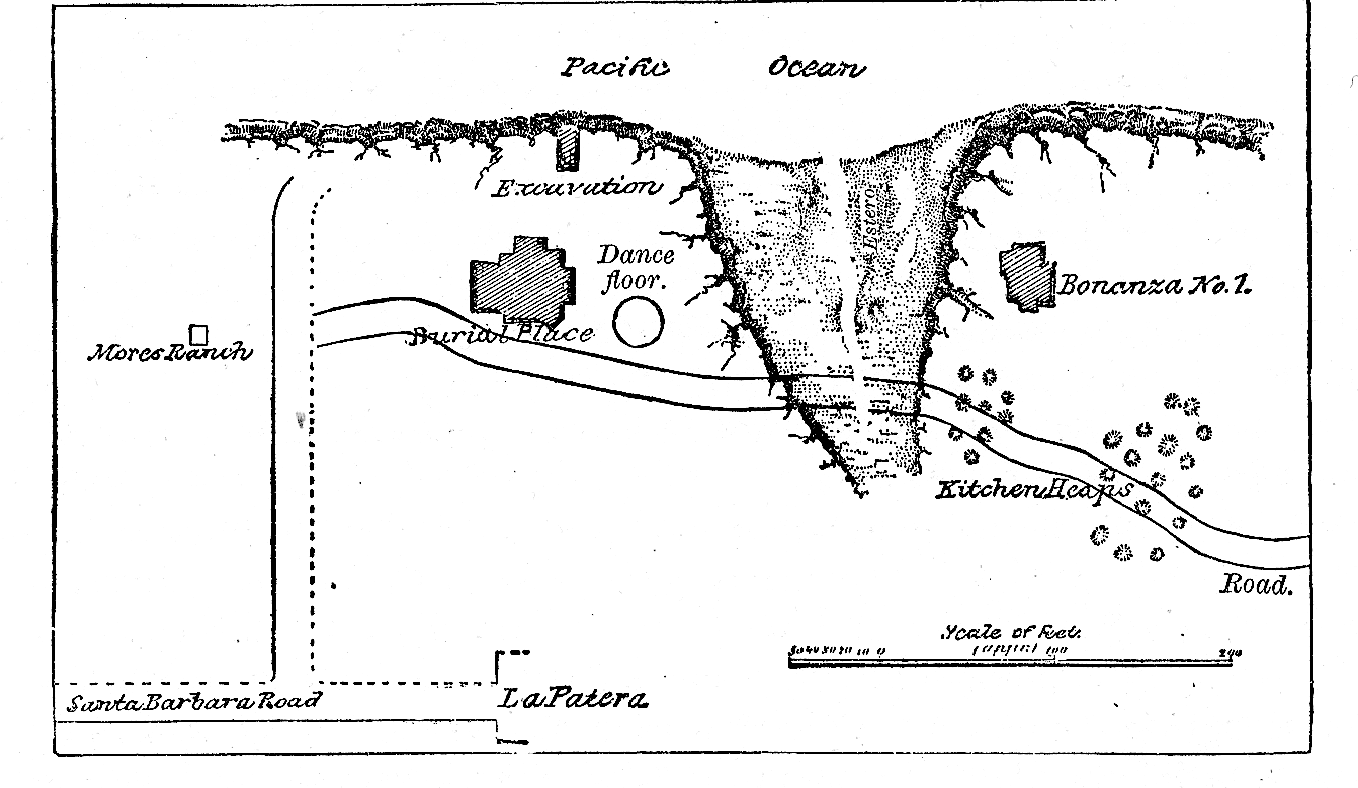
1875 Map of U.S. Archeological Expedition - The `Bonanza #1' is thought to have been on Mescalitan Island
1888 Santa Barbara County Map
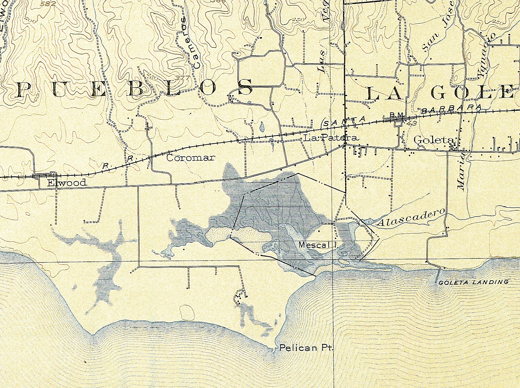
1902 Survey, 1903 USGS Engraving (15')
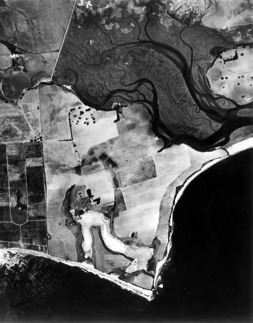
1928 Aerial photo of much of the slough
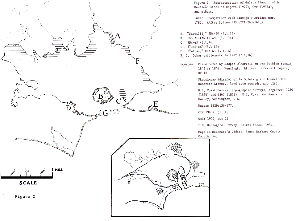
1929 Map of Roger's Reconstruction of the Slough
1938 Aerial photo of much of the slough
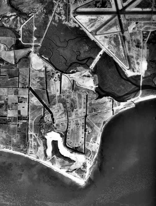
1943 Aerial photo of much of the slough
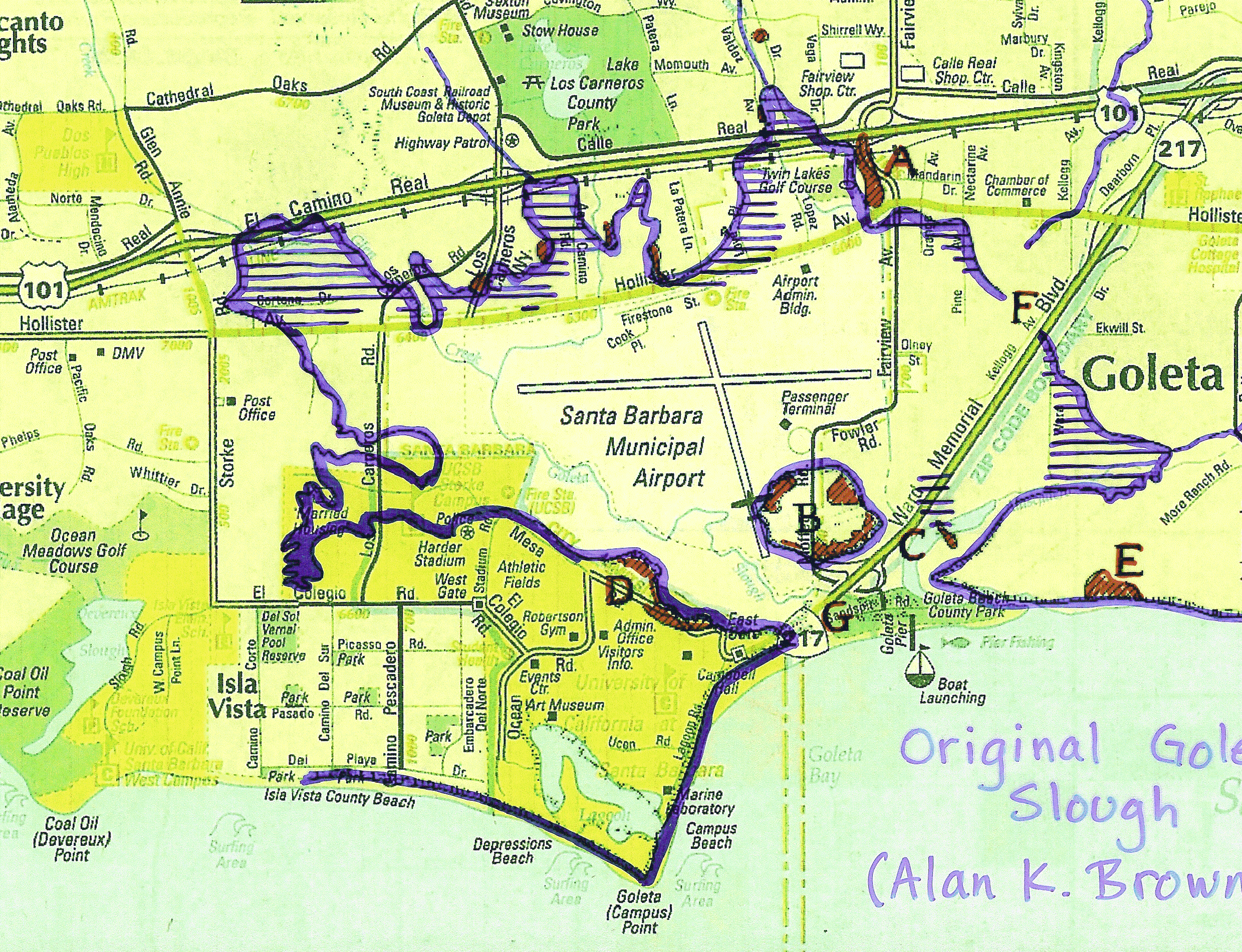
1967 Map of A.K. Brown's Reconstruction of the Slough
1967 Map of A.K. Brown's Reconstruction of the Slough, overlaid on a modern map
RFG Presentation
hnn@hep.ucsb.edu
06/19/03